DEAIS: Changes in the Drainage Pattern of the Eastern Antarctic Ice Sheet through Time
Our researcher Naki Akçar is again on an antarctic research tour. The assessment of the stability of Antarctic ice sheets and of their contribution to the global sea level change as a response to climate change requires the reconstruction of their past volume variations. For instance, dramatic surface lowering of East Antarctic Ice Sheet (EAIS) during the last million years have been recently reported. However, the spatial distribution of this lowering remains unexplored. Today, Sør Rondane Mountains in the Queen Maud Land acts as a barrier to the EAIS. This is displayed by the difference in altitude of the ice surface to the south and north of the mountain chain. To the south, ice surface reaches altitudes above 2500 meters above sea level. Lowlands of ice are found at altitudes of around 1500 meters to the north of the mountain chain.
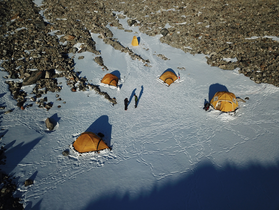
During the BELARE 2017-2018 Expedition, we successfully completed a reconnaissance field campaign at the nunataks in the vicinity of the Princess Elisabeth Station (PEA). In the field, we identified abandoned valleys situated at elevations few hundred meters above today’s ice surface, which point to a dramatic surface lowering and thus a change in drainage pattern in time. In this project, we aim to use suite of cosmogenic nuclides (10Be, 14C, 26Al and 36Cl) to decipher the timing, magnitude and frequency of the surface lowering history and change in drainage pattern of the EAIS in the western Sør Rondane Mountains. To do this, we focus on the nunataks at Mount Nils Larsen and Walnum Mountains.
See also report from Naki Akçar.


